
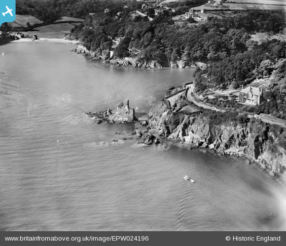
EPW024196 ENGLAND (1928). The ruins of Fort Charles and the nearby coast, Salcombe, 1928
© Copyright OpenStreetMap contributors and licensed by the OpenStreetMap Foundation. 2025. Cartography is licensed as CC BY-SA.
Nearby Images (3)
EPW024196

EPW024200

EAW007573

Details
| Title | [EPW024196] The ruins of Fort Charles and the nearby coast, Salcombe, 1928 |
| Reference | EPW024196 |
| Date | September-1928 |
| Link | |
| Place name | SALCOMBE |
| Parish | SALCOMBE |
| District | |
| Country | ENGLAND |
| Easting / Northing | 273387, 38076 |
| Longitude / Latitude | -3.7753312906048, 50.228488182917 |
| National Grid Reference | SX734381 |
Pins

stephen |
Thursday 28th of June 2012 09:28:47 AM |