
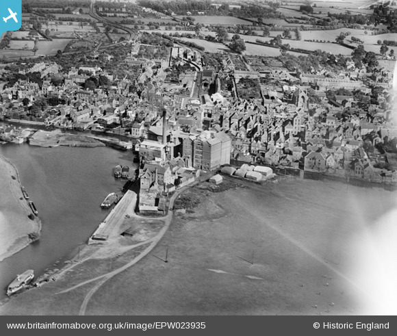
EPW023935 ENGLAND (1928). Borough Flour Mills and environs, Tewkesbury, 1928
© Copyright OpenStreetMap contributors and licensed by the OpenStreetMap Foundation. 2025. Cartography is licensed as CC BY-SA.
Nearby Images (4)
EPW023935

EPW023933

EAW006889

EAW006890

Details
| Title | [EPW023935] Borough Flour Mills and environs, Tewkesbury, 1928 |
| Reference | EPW023935 |
| Date | September-1928 |
| Link | |
| Place name | TEWKESBURY |
| Parish | TEWKESBURY |
| District | |
| Country | ENGLAND |
| Easting / Northing | 389210, 232994 |
| Longitude / Latitude | -2.1571699832929, 51.994862185062 |
| National Grid Reference | SO892330 |
Pins

peter stuart legat |
Sunday 26th of April 2020 11:50:51 AM | |
|
peter stuart legat |
Sunday 26th of April 2020 11:45:32 AM | |
|
peter stuart legat |
Sunday 26th of April 2020 11:43:22 AM | |
|
galatea |
Sunday 1st of February 2015 10:00:49 PM | |
|
galatea |
Sunday 1st of February 2015 09:59:24 PM | |
|
galatea |
Sunday 1st of February 2015 09:57:07 PM | |
|
MB |
Wednesday 7th of November 2012 06:14:42 PM | |
|
Toby Clempson |
Tuesday 26th of June 2012 07:20:03 AM | |
The tracks also crossed the High Street, and served the quay, as can be seen. |
Isleworth1961 |
Thursday 2nd of August 2012 10:40:19 AM |