
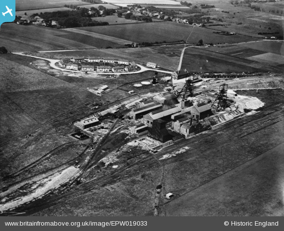
EPW019033 ENGLAND (1927). Betteshanger Colliery and miners housing at Circular Road, Northbourne, 1927. This image has been produced from a print.
© Copyright OpenStreetMap contributors and licensed by the OpenStreetMap Foundation. 2026. Cartography is licensed as CC BY-SA.
Nearby Images (3)
EPW019033

EPW019034

EPW019032

Details
| Title | [EPW019033] Betteshanger Colliery and miners housing at Circular Road, Northbourne, 1927. This image has been produced from a print. |
| Reference | EPW019033 |
| Date | 3-August-1927 |
| Link | |
| Place name | NORTHBOURNE |
| Parish | NORTHBOURNE |
| District | |
| Country | ENGLAND |
| Easting / Northing | 633635, 152940 |
| Longitude / Latitude | 1.3466762163363, 51.227233209811 |
| National Grid Reference | TR336529 |
Pins
Be the first to add a comment to this image!