
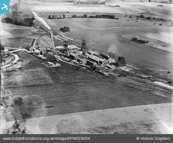
EPW019034 ENGLAND (1927). Betteshanger Colliery, Northbourne, 1927
© Copyright OpenStreetMap contributors and licensed by the OpenStreetMap Foundation. 2026. Cartography is licensed as CC BY-SA.
Nearby Images (3)
EPW019034

EPW019033

EPW019032

Details
| Title | [EPW019034] Betteshanger Colliery, Northbourne, 1927 |
| Reference | EPW019034 |
| Date | 3-August-1927 |
| Link | |
| Place name | NORTHBOURNE |
| Parish | NORTHBOURNE |
| District | |
| Country | ENGLAND |
| Easting / Northing | 633612, 152936 |
| Longitude / Latitude | 1.3463447510141, 51.227206712852 |
| National Grid Reference | TR336529 |
Pins

MB |
Wednesday 10th of October 2012 10:44:33 PM | |
|
MB |
Wednesday 10th of October 2012 10:39:53 PM | |
|
MB |
Wednesday 10th of October 2012 10:38:02 PM | |
|
MB |
Wednesday 10th of October 2012 10:32:23 PM | |
|
MB |
Wednesday 10th of October 2012 10:30:54 PM | |
|
MB |
Wednesday 10th of October 2012 10:29:56 PM | |
|
MB |
Wednesday 10th of October 2012 10:28:57 PM | |
|
MB |
Wednesday 10th of October 2012 10:28:41 PM | |
|
MB |
Wednesday 10th of October 2012 10:27:47 PM |
