
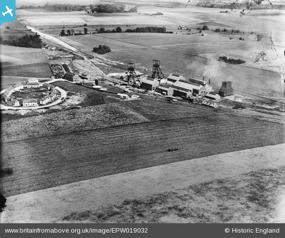
EPW019032 ENGLAND (1927). Betteshanger Colliery and miners housing at Circular Road, Northbourne, 1927
© Copyright OpenStreetMap contributors and licensed by the OpenStreetMap Foundation. 2026. Cartography is licensed as CC BY-SA.
Nearby Images (3)
EPW019032

EPW019034

EPW019033

Details
| Title | [EPW019032] Betteshanger Colliery and miners housing at Circular Road, Northbourne, 1927 |
| Reference | EPW019032 |
| Date | 3-August-1927 |
| Link | |
| Place name | NORTHBOURNE |
| Parish | NORTHBOURNE |
| District | |
| Country | ENGLAND |
| Easting / Northing | 633528, 152947 |
| Longitude / Latitude | 1.3451508707081, 51.227339837628 |
| National Grid Reference | TR335529 |
Pins

Class31 |
Friday 12th of April 2013 11:57:57 AM |
User Comment Contributions
View looking east. |
Class31 |
Friday 12th of April 2013 11:59:26 AM |