
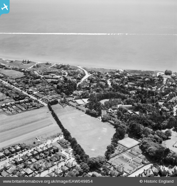
EAW049854 ENGLAND (1953). St Peter's School Playing Field looking towards Warren Edge Road and the coastline, Southbourne, from the north, 1953. This image was marked by Aerofilms Ltd for photo editing.
© Copyright OpenStreetMap contributors and licensed by the OpenStreetMap Foundation. 2025. Cartography is licensed as CC BY-SA.
Nearby Images (9)
EAW049854

EAW049853

EAW049849

EAW049852

EAW049850

EAW049851

EAW049847

EAW049848

EAW049855

Details
| Title | [EAW049854] St Peter's School Playing Field looking towards Warren Edge Road and the coastline, Southbourne, from the north, 1953. This image was marked by Aerofilms Ltd for photo editing. |
| Reference | EAW049854 |
| Date | 9-June-1953 |
| Link | |
| Place name | SOUTHBOURNE |
| Parish | |
| District | |
| Country | ENGLAND |
| Easting / Northing | 414777, 91650 |
| Longitude / Latitude | -1.7906309299229, 50.723711498006 |
| National Grid Reference | SZ148917 |
Pins
Be the first to add a comment to this image!