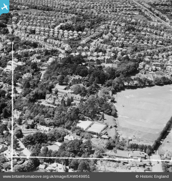
EAW049851 ENGLAND (1953). St Peter's School and Playing Field, Southbourne, 1953. This image was marked by Aerofilms Ltd for photo editing.
© Copyright OpenStreetMap contributors and licensed by the OpenStreetMap Foundation. 2025. Cartography is licensed as CC BY-SA.
Nearby Images (8)
Details
| Title | [EAW049851] St Peter's School and Playing Field, Southbourne, 1953. This image was marked by Aerofilms Ltd for photo editing. |
| Reference | EAW049851 |
| Date | 9-June-1953 |
| Link | |
| Place name | SOUTHBOURNE |
| Parish | |
| District | |
| Country | ENGLAND |
| Easting / Northing | 414693, 91609 |
| Longitude / Latitude | -1.7918227158973, 50.723344889521 |
| National Grid Reference | SZ147916 |
Pins

divingdave |
Tuesday 7th of June 2022 01:39:39 PM | |

divingdave |
Tuesday 7th of June 2022 01:39:21 PM | |

divingdave |
Tuesday 7th of June 2022 01:37:35 PM | |

divingdave |
Tuesday 7th of June 2022 01:37:24 PM | |

divingdave |
Tuesday 7th of June 2022 01:37:13 PM | |

divingdave |
Tuesday 7th of June 2022 01:36:37 PM | |

divingdave |
Tuesday 7th of June 2022 01:35:05 PM | |

divingdave |
Tuesday 7th of June 2022 01:34:30 PM | |

divingdave |
Tuesday 7th of June 2022 01:33:51 PM | |

divingdave |
Tuesday 7th of June 2022 01:32:04 PM | |

divingdave |
Tuesday 7th of June 2022 01:31:22 PM | |

divingdave |
Tuesday 7th of June 2022 01:30:56 PM | |

divingdave |
Tuesday 7th of June 2022 01:30:36 PM | |

divingdave |
Tuesday 7th of June 2022 01:30:10 PM |


![[EAW049851] St Peter's School and Playing Field, Southbourne, 1953. This image was marked by Aerofilms Ltd for photo editing.](http://britainfromabove.org.uk/sites/all/libraries/aerofilms-images/public/100x100/EAW/049/EAW049851.jpg)
![[EAW049850] St Peter's School and Playing Field, Southbourne, 1953. This image was marked by Aerofilms Ltd for photo editing.](http://britainfromabove.org.uk/sites/all/libraries/aerofilms-images/public/100x100/EAW/049/EAW049850.jpg)
![[EAW049847] St Peter's School on St Catherine's Road, Southbourne, 1953. This image was marked by Aerofilms Ltd for photo editing.](http://britainfromabove.org.uk/sites/all/libraries/aerofilms-images/public/100x100/EAW/049/EAW049847.jpg)
![[EAW049848] St Peter's School on St Catherine's Road, Southbourne, 1953. This image was marked by Aerofilms Ltd for photo editing.](http://britainfromabove.org.uk/sites/all/libraries/aerofilms-images/public/100x100/EAW/049/EAW049848.jpg)
![[EAW049849] St Peter's School and Playing Field, Southbourne, 1953. This image was marked by Aerofilms Ltd for photo editing.](http://britainfromabove.org.uk/sites/all/libraries/aerofilms-images/public/100x100/EAW/049/EAW049849.jpg)
![[EAW049852] St Peter's School and Playing Field, Southbourne, 1953. This image was marked by Aerofilms Ltd for photo editing.](http://britainfromabove.org.uk/sites/all/libraries/aerofilms-images/public/100x100/EAW/049/EAW049852.jpg)
![[EAW049854] St Peter's School Playing Field looking towards Warren Edge Road and the coastline, Southbourne, from the north, 1953. This image was marked by Aerofilms Ltd for photo editing.](http://britainfromabove.org.uk/sites/all/libraries/aerofilms-images/public/100x100/EAW/049/EAW049854.jpg)
![[EAW049853] St Peter's School and Playing Field, Southbourne, 1953. This image was marked by Aerofilms Ltd for photo editing.](http://britainfromabove.org.uk/sites/all/libraries/aerofilms-images/public/100x100/EAW/049/EAW049853.jpg)