Skip to main content
Britain from Above
Cymraeg
|
English
Login
|
Register
Toggle navigation
Home
Legacy
About
Map
Galleries
Groups
Help
Search
All Countries (96344)
England (82521)
Scotland (6398)
Wales (4321)
Rest of World (3104)
Belgium (7)
France (27)
Germany (2)
Guernsey (116)
Iran (8)
Iraq (6)
Ireland (1466)
Isle of Man (75)
Jersey (122)
Netherlands (20)
Northern Ireland (1163)
Spain (9)
Switzerland (26)
Latest Activity
Saved Images
Pagination
First page
first
Previous page
previous
…
Page
2
Page
3
Page
4
Page
5
Current page
6
Page
7
Page
8
Page
9
Page
10
…
Next page
next
Last page
last
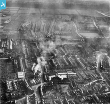
[EAW012087] Housing at Lilac Crescent and Rose Grove, Rylands, 1947
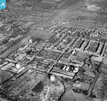
[EAW012085] The Ericsson Telephone Works, Rylands, 1947
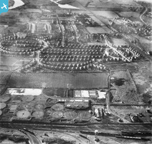
[EAW012084] Housing at Redwood Crescent and the Ericsson Telephone Works, Rylands, 1947
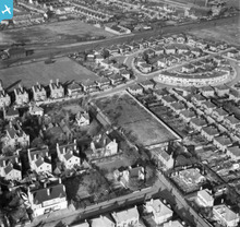
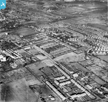
[EAW012083] The residential area surrounding Queens Road and Dovecote Lane, Rylands, 1947
[EAW012082] The Beeston County Secondary Girls School (John Clifford School) and the surrounding residential area, Rylands, 1947
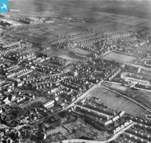
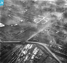
[EAW012081] Padge Bridge and the residential area surrounding Lilac Crescent, Rylands, 1947
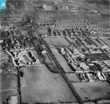
[EAW012080] The residential area surrounding Leyton Crescent and the adjacent Sewage Works, Rylands, 1947
[EAW012086] The residential area surrounding Trent Road and Meadow Road, Rylands, 1947
Pagination
First page
first
Previous page
previous
…
Page
2
Page
3
Page
4
Page
5
Current page
6
Page
7
Page
8
Page
9
Page
10
…
Next page
next
Last page
last
This user has had no activity in the last year.