
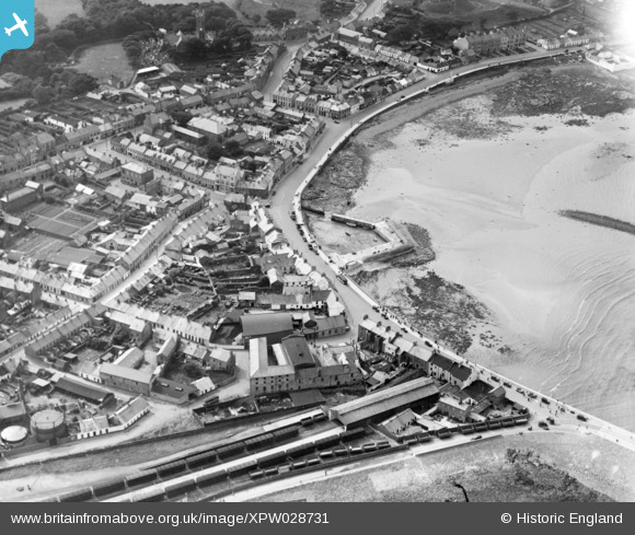
XPW028731 NORTHERN IRELAND (1929). Seafront, Donaghadee, Ards, Northern Ireland, 1929. Oblique aerial photograph taken facing West.
© Copyright OpenStreetMap contributors and licensed by the OpenStreetMap Foundation. 2026. Cartography is licensed as CC BY-SA.
Nearby Images (4)
XPW028731

XPW028732

XPW028733

XPW028730

Details
| Title | [XPW028731] Seafront, Donaghadee, Ards, Northern Ireland, 1929. Oblique aerial photograph taken facing West. |
| Reference | XPW028731 |
| Date | 1929 |
| Link | |
| Place name | DONAGHADEE |
| Parish | NORTHERN IRELAND |
| District | |
| Country | NORTHERN IRELAND |
| Easting / Northing | 171996, 533229 |
| Longitude / Latitude | -5.535103, 54.642497 |
| National Grid Reference |
Pins
Be the first to add a comment to this image!