
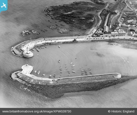
XPW028730 NORTHERN IRELAND (1929). Donaghadee Harbour, Donaghadee, Ards, Northern Ireland, 1929. Oblique aerial photograph taken facing South.
© Copyright OpenStreetMap contributors and licensed by the OpenStreetMap Foundation. 2026. Cartography is licensed as CC BY-SA.
Nearby Images (3)
XPW028730

XPW028733

XPW028731

Details
| Title | [XPW028730] Donaghadee Harbour, Donaghadee, Ards, Northern Ireland, 1929. Oblique aerial photograph taken facing South. |
| Reference | XPW028730 |
| Date | 1929 |
| Link | |
| Place name | DONAGHADEE |
| Parish | NORTHERN IRELAND |
| District | |
| Country | NORTHERN IRELAND |
| Easting / Northing | 172182, 533463 |
| Longitude / Latitude | -5.532417, 54.644685 |
| National Grid Reference |
Pins

IntrepidExplorer82 |
Saturday 23rd of December 2017 08:10:11 PM | |
|
john little |
Saturday 18th of October 2014 09:59:57 PM |