
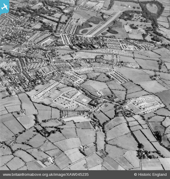
XAW045235 NORTHERN IRELAND (1952). General View, Gilnahirk, Castlereagh, Northern Ireland, 1952. Oblique aerial photograph taken facing North.
© Copyright OpenStreetMap contributors and licensed by the OpenStreetMap Foundation. 2026. Cartography is licensed as CC BY-SA.
Nearby Images (3)
XAW045235

XAW045228

XAW045229

Details
| Title | [XAW045235] General View, Gilnahirk, Castlereagh, Northern Ireland, 1952. Oblique aerial photograph taken facing North. |
| Reference | XAW045235 |
| Date | 1952 |
| Link | |
| Place name | GILNAHIRK |
| Parish | NORTHERN IRELAND |
| District | |
| Country | NORTHERN IRELAND |
| Easting / Northing | 152124, 528377 |
| Longitude / Latitude | -5.83825, 54.589619 |
| National Grid Reference |
Pins
Be the first to add a comment to this image!