
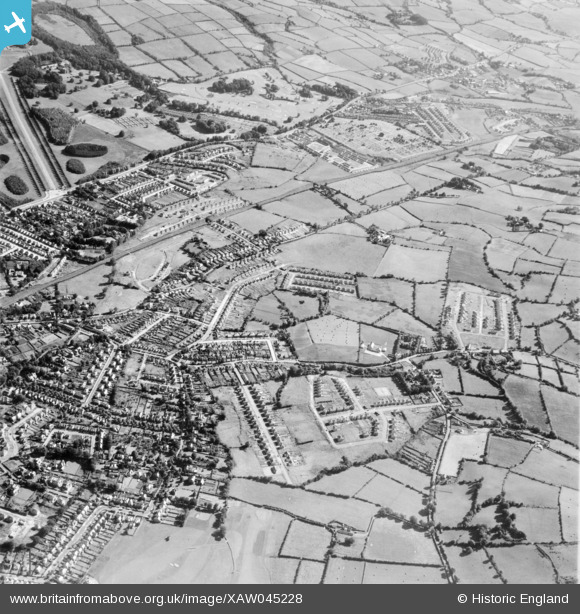
XAW045228 NORTHERN IRELAND (1952). General View, Gilnahirk, Castlereagh, Northern Ireland, 1952. Oblique aerial photograph taken facing North/East.
© Copyright OpenStreetMap contributors and licensed by the OpenStreetMap Foundation. 2026. Cartography is licensed as CC BY-SA.
Nearby Images (3)
XAW045228

XAW045229

XAW045235

Details
| Title | [XAW045228] General View, Gilnahirk, Castlereagh, Northern Ireland, 1952. Oblique aerial photograph taken facing North/East. |
| Reference | XAW045228 |
| Date | 1952 |
| Link | |
| Place name | GILNAHIRK |
| Parish | NORTHERN IRELAND |
| District | |
| Country | NORTHERN IRELAND |
| Easting / Northing | 152301, 528205 |
| Longitude / Latitude | -5.83537, 54.58817 |
| National Grid Reference |
Pins

Rose |
Wednesday 14th of September 2022 09:34:49 AM | |
|
IntrepidExplorer82 |
Wednesday 23rd of September 2020 10:21:37 PM | |
|
yourpete |
Monday 17th of November 2014 01:06:52 AM | |
|
Buzby |
Friday 31st of October 2014 01:47:51 PM | |
|
Buzby |
Friday 31st of October 2014 01:46:17 PM |