
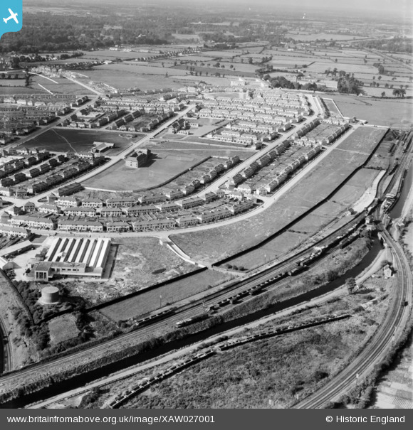
XAW027001 IRELAND (1949). Bannon Road, Dublin, Dublin, Ireland, 1949. Oblique aerial photograph taken facing West.
© Copyright OpenStreetMap contributors and licensed by the OpenStreetMap Foundation. 2026. Cartography is licensed as CC BY-SA.
Nearby Images (12)
XAW027001

XAW027005

XAW027006

XAW027002

XAW027003

XAW026995
 Ltd., Dublin, Dublin, Ireland, 1949. Oblique aerial photograph taken facing North/East. This image was marked by Aerofilms Ltd for photo editing and has been produced from a damaged negative.")
XAW026996
 Ltd., Dublin, Dublin, Ireland, 1949. Oblique aerial photograph taken facing East. This image was marked by Aerofilms Ltd for photo editing.")
XAW026994

XAW026998
 Ltd., Dublin, Dublin, Ireland, 1949. Oblique aerial photograph taken facing South/East. This image was marked by Aerofilms Ltd for photo editing.")
XAW026997
 Ltd., Dublin, Dublin, Ireland, 1949. Oblique aerial photograph taken facing North. This image was marked by Aerofilms Ltd for photo editing.")
XAW026999
 Ltd., Dublin, Dublin, Ireland, 1949. Oblique aerial photograph taken facing South/West. This image was marked by Aerofilms Ltd for photo editing.")
XAW027000
 Ltd., Dublin, Dublin, Ireland, 1949. Oblique aerial photograph taken facing South/East. This image was marked by Aerofilms Ltd for photo editing.")
Details
| Title | [XAW027001] Bannon Road, Dublin, Dublin, Ireland, 1949. Oblique aerial photograph taken facing West. |
| Reference | XAW027001 |
| Date | 30-September-1949 |
| Link | |
| Place name | DUBLIN |
| Parish | IRELAND |
| District | |
| Country | IRELAND |
| Easting / Northing | 114553, 394386 |
| Longitude / Latitude | -6.292536, 53.369021 |
| National Grid Reference |
Pins

David Doyle |
Friday 1st of December 2017 05:00:52 PM | |
|
David Doyle |
Friday 1st of December 2017 04:59:02 PM | |

powerpop |
Tuesday 14th of October 2014 08:35:32 PM | |
|
powerpop |
Tuesday 14th of October 2014 05:59:21 PM | |
|
powerpop |
Tuesday 14th of October 2014 05:58:33 PM | |
|
powerpop |
Tuesday 14th of October 2014 05:56:40 PM | |
|
powerpop |
Tuesday 14th of October 2014 05:56:22 PM | |
|
powerpop |
Tuesday 14th of October 2014 05:55:57 PM |