
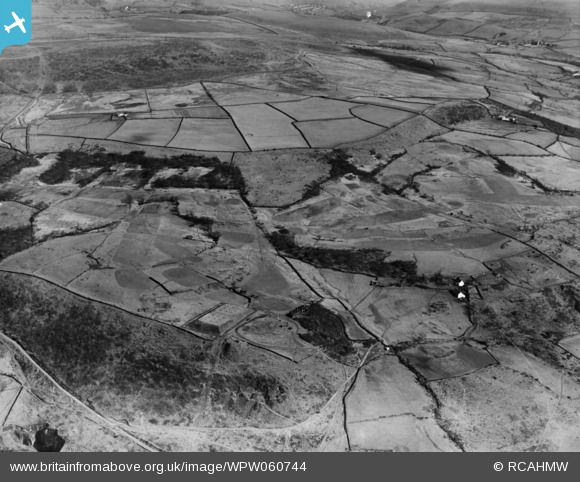
WPW060744 WALES (1939). View of landscape near Gwaelod-y-Garth, oblique aerial view. 5"x4" black and white glass plate negative.
© Copyright OpenStreetMap contributors and licensed by the OpenStreetMap Foundation. 2025. Cartography is licensed as CC BY-SA.
Nearby Images (6)
WPW060742

WPW060743

WPW060744

WPW060745

WPW060746

WPW060747

Details
| Title | [WPW060744] View of landscape near Gwaelod-y-Garth, oblique aerial view. 5"x4" black and white glass plate negative. |
| Reference | WPW060744 |
| Date | 1939 |
| Link | Coflein Archive Item 6370503 |
| Place name | |
| Parish | |
| District | |
| Country | WALES |
| Easting / Northing | 311560, 183990 |
| Longitude / Latitude | -3.2755870044834, 51.547385493184 |
| National Grid Reference | ST116840 |
Pins
User Comment Contributions
View taken above Pontypridd looking South East towards Abertridwr over Cefn Eglwysilan. The reservoir is the most prominent feature to aid identification. Photo taken from Grid ST 08189 90819. Title will need to be changed to view South East over Pontypridd Golf Course. |
 Class31 |
Wednesday 18th of July 2012 08:39:02 AM |