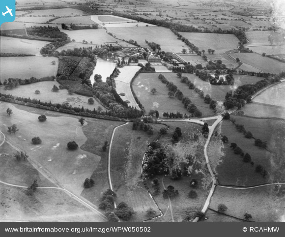
WPW050502 WALES (1936). View of Tredegar Park, oblique aerial view. 5"x4" black and white glass plate negative.
© Copyright OpenStreetMap contributors and licensed by the OpenStreetMap Foundation. 2026. Cartography is licensed as CC BY-SA.
Nearby Images (4)
WPW050500

WPW050502

WPW050503

WPW050597

Details
| Title | [WPW050502] View of Tredegar Park, oblique aerial view. 5"x4" black and white glass plate negative. |
| Reference | WPW050502 |
| Date | 1936 |
| Link | Coflein Archive Item 6369997 |
| Place name | |
| Parish | |
| District | |
| Country | WALES |
| Easting / Northing | 328889, 185326 |
| Longitude / Latitude | -3.0259661206895, 51.561848065967 |
| National Grid Reference | ST289853 |
Pins

TomRobin |
Tuesday 3rd of December 2013 12:18:22 PM | |

Class31 |
Monday 28th of October 2013 02:37:23 PM | |
|
billd |
Friday 31st of August 2012 09:05:50 PM | |
|
billd |
Friday 31st of August 2012 09:04:59 PM | |
|
billd |
Friday 31st of August 2012 09:02:44 PM | |
|
billd |
Friday 31st of August 2012 09:00:19 PM | |
|
and1newport |
Monday 2nd of July 2012 12:59:31 PM | |
Are you sure? I think it is part of Junction 28 of the M4. |
billd |
Friday 31st of August 2012 08:58:13 PM |