
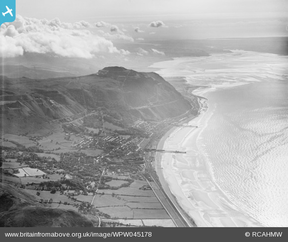
WPW045178 WALES (1934). Distant view of Penmaenmawr, oblique aerial view. 5"x4" black and white glass plate negative.
© Copyright OpenStreetMap contributors and licensed by the OpenStreetMap Foundation. 2025. Cartography is licensed as CC BY-SA.
Nearby Images (21)
WAW010001

WAW010002

WAW010003

WAW010006

WAW010007

WAW010008

WAW010010

WAW010011

WAW010484

WAW010485

WAW010486

WAW017362

WPW040136

WPW040137

WPW040138

WPW040139

WPW045177

WPW045178

WPW045179

WPW045180

WPW055738

Details
| Title | [WPW045178] Distant view of Penmaenmawr, oblique aerial view. 5"x4" black and white glass plate negative. |
| Reference | WPW045178 |
| Date | 1934 |
| Link | Coflein Archive Item 6369875 |
| Place name | |
| Parish | |
| District | |
| Country | WALES |
| Easting / Northing | 271000, 376000 |
| Longitude / Latitude | -3.9343604965008, 53.265009852739 |
| National Grid Reference | SH710760 |

