
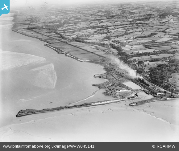
WPW045141 WALES (1934). View of Mostyn showing Barwen & Mostyn Iron Co., oblique aerial view. 5"x4" black and white glass plate negative.
© Copyright OpenStreetMap contributors and licensed by the OpenStreetMap Foundation. 2026. Cartography is licensed as CC BY-SA.
Nearby Images (17)
WPW045134

WPW045135

WPW045136

WPW045137

WPW045138

WPW045139

WPW045140

WPW045141

WPW045142

WPW045150

WPW045151

WPW045152

WPW045153

WPW045154

WPW045155

WPW045156

WPW055767

Details
| Title | [WPW045141] View of Mostyn showing Barwen & Mostyn Iron Co., oblique aerial view. 5"x4" black and white glass plate negative. |
| Reference | WPW045141 |
| Date | 1934 |
| Link | Coflein Archive Item 6369841 |
| Place name | |
| Parish | |
| District | |
| Country | WALES |
| Easting / Northing | 316070, 380330 |
| Longitude / Latitude | -3.2599052538566, 53.312973713924 |
| National Grid Reference | SJ161803 |
Pins

Mostyn |
Tuesday 21st of August 2012 11:06:48 PM | |
|
Mostyn |
Tuesday 21st of August 2012 11:06:03 PM | |
|
Mostyn |
Tuesday 21st of August 2012 11:05:16 PM | |
do you know anything about this bridge? I'm trying to research it's history! |
jackndanni |
Thursday 23rd of May 2013 08:43:51 AM |