
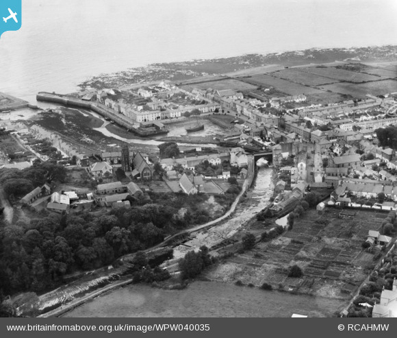
WPW040035 WALES (1932). General view of Aberaeron, oblique aerial view. 5"x4" black and white glass plate negative.
© Copyright OpenStreetMap contributors and licensed by the OpenStreetMap Foundation. 2026. Cartography is licensed as CC BY-SA.
Nearby Images (11)
WAW043989

WAW043990

WAW043991

WAW043992

WAW043993

WAW043994

WAW043997

WAW043998

WPW040034

WPW040035

WPW040036

Details
| Title | [WPW040035] General view of Aberaeron, oblique aerial view. 5"x4" black and white glass plate negative. |
| Reference | WPW040035 |
| Date | 1932 |
| Link | Coflein Archive Item 6369648 |
| Place name | |
| Parish | |
| District | |
| Country | WALES |
| Easting / Northing | 245938, 262877 |
| Longitude / Latitude | -4.2567023810347, 52.242088810549 |
| National Grid Reference | SN459629 |
Pins

BarbaraC |
Wednesday 3rd of August 2016 12:23:45 PM | |
|
huwbbc |
Tuesday 26th of June 2012 11:56:50 AM | |
|
huwbbc |
Tuesday 26th of June 2012 11:56:27 AM | |
|
huwbbc |
Tuesday 26th of June 2012 11:56:05 AM | |
|
huwbbc |
Tuesday 26th of June 2012 11:55:46 AM | |
|
huwbbc |
Tuesday 26th of June 2012 11:55:09 AM |