
WPW029799 WALES (1929). View of Neath, oblique aerial view. 5"x4" black and white glass plate negative.

© Copyright OpenStreetMap contributors and licensed by the OpenStreetMap Foundation. 2026. Cartography is licensed as CC BY-SA.
Nearby Images (5)
WPW029799

WPW029802

WPW029804

WPW029805

WPW029807

Details
| Title | [WPW029799] View of Neath, oblique aerial view. 5"x4" black and white glass plate negative. |
| Reference | WPW029799 |
| Date | 1929 |
| Link | Coflein Archive Item 6370649 |
| Place name | |
| Parish | |
| District | |
| Country | WALES |
| Easting / Northing | 274000, 197000 |
| Longitude / Latitude | -3.8217466213702, 51.657179567368 |
| National Grid Reference | SS740970 |
Pins

jacobbayliss |
Sunday 24th of December 2023 02:11:38 PM | |
|
gBr |
Wednesday 7th of January 2015 04:18:32 PM | |
|
gBr |
Wednesday 7th of January 2015 04:15:43 PM | |
|
gBr |
Wednesday 7th of January 2015 04:01:51 PM | |

Class31 |
Monday 28th of October 2013 12:22:44 PM | |
|
Class31 |
Monday 28th of October 2013 12:19:38 PM | |
|
Debs |
Sunday 21st of October 2012 08:47:47 PM | |
|
antojo |
Wednesday 12th of September 2012 10:16:22 AM | |
|
Enthusiast |
Sunday 26th of August 2012 07:45:39 PM | |
|
Enthusiast |
Sunday 26th of August 2012 07:30:42 PM | |
|
Enthusiast |
Sunday 26th of August 2012 07:08:07 PM | |
|
Enthusiast |
Sunday 26th of August 2012 07:04:45 PM | |
|
Enthusiast |
Sunday 26th of August 2012 06:59:36 PM | |
|
Enthusiast |
Sunday 26th of August 2012 06:55:18 PM | |
|
Geraint |
Saturday 4th of August 2012 03:16:22 PM | |
|
BRIAN TAYLOR |
Tuesday 10th of July 2012 02:14:40 PM | |
|
BRIAN TAYLOR |
Tuesday 10th of July 2012 02:11:20 PM | |
|
algy |
Thursday 5th of July 2012 09:51:13 PM | |
|
Class31 |
Monday 2nd of July 2012 10:08:40 AM | |
|
Class31 |
Monday 2nd of July 2012 10:08:39 AM | |
|
Class31 |
Monday 2nd of July 2012 10:07:40 AM | |
|
Dai |
Wednesday 27th of June 2012 07:11:47 AM | |
|
Dai |
Wednesday 27th of June 2012 07:11:10 AM | |
Some early OS maps label as Town station, better known as Neath General. |
gBr |
Wednesday 7th of January 2015 04:08:19 PM |
|
Dai |
Wednesday 27th of June 2012 07:10:50 AM |


User Comment Contributions
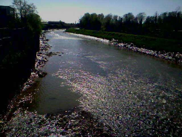
river at low tide.this photo is taken alongside quay road from bridge st.Ships came up past this point,but it was 1956 the last time the swingbridge lower down the river was opened.i'm not sure if the port of neath will be doing any trading soon. |
greg |
Monday 5th of May 2014 05:25:20 PM |

tennant canal emptys into the river neath at low tide |
greg |
Monday 5th of May 2014 05:14:22 PM |

Victoria Gardens, Neath |
Class31 |
Monday 28th of October 2013 12:08:56 PM |
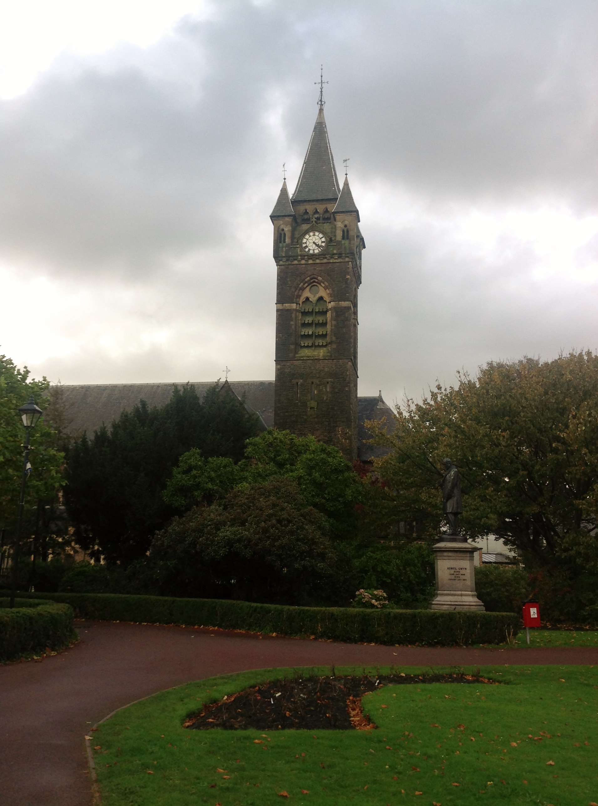
St. David's Church and statue to Howel Gwyn, Neath |
Class31 |
Monday 28th of October 2013 12:05:43 PM |

Statue to Howel Gwyn in Victoria Gardens |
Class31 |
Monday 28th of October 2013 12:03:47 PM |