
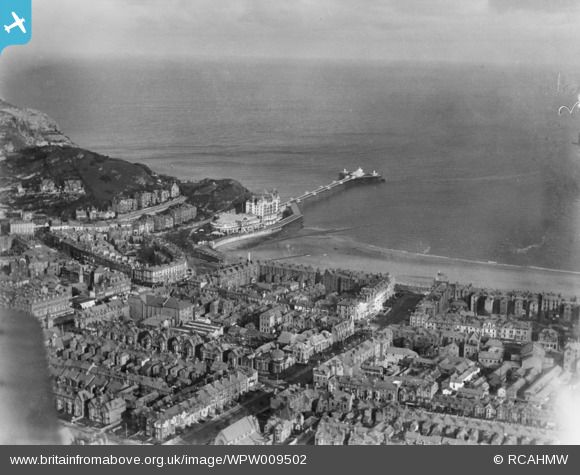
WPW009502 WALES (1923). View of Llandudno showing pier, oblique aerial view. 5"x4" black and white glass plate negative.
© Copyright OpenStreetMap contributors and licensed by the OpenStreetMap Foundation. 2026. Cartography is licensed as CC BY-SA.
Nearby Images (48)
WPW003014

WPW003015

WPW003016

WPW003017

WPW003018

WPW003019

WPW003020

WPW003021

WPW003022

WPW003023

WPW003024

WPW003025

WPW003026

WPW003027

WPW003028

WPW003029

WPW003030

WPW003031

WPW003032

WPW003033

WPW003034

WPW003035

WPW009501

WPW009502

WPW009503

WPW009504

WPW009505

WPW009506

WPW009507
, oblique aerial view. 5\"x4\" black and white glass plate negative.")
WPW009508

WPW009509
, oblique aerial view. 5\"x4\" black and white glass plate negative.")
WPW009510
, oblique aerial view. 5\"x4\" black and white glass plate negative.")
WPW009511
, oblique aerial view. 5\"x4\" black and white glass plate negative.")
WPW009512
, oblique aerial view. 5\"x4\" black and white glass plate negative.")
WPW009513
, oblique aerial view. 5\"x4\" black and white glass plate negative.")
WPW009514
, oblique aerial view. 5\"x4\" black and white glass plate negative.")
WPW009515
, oblique aerial view. 5\"x4\" black and white glass plate negative.")
WPW009516
, oblique aerial view. 5\"x4\" black and white glass plate negative.")
WPW009517
, oblique aerial view. 5\"x4\" black and white glass plate negative.")
WPW009518
, oblique aerial view. 5\"x4\" black and white glass plate negative.")
WPW009519
, oblique aerial view. 5\"x4\" black and white glass plate negative.")
WPW040118

WPW040119

WPW040120

WPW040121

WPW040122

WPW045175

WPW045176

Details
| Title | [WPW009502] View of Llandudno showing pier, oblique aerial view. 5"x4" black and white glass plate negative. |
| Reference | WPW009502 |
| Date | 1923 |
| Link | Coflein Archive Item 6378189 |
| Place name | |
| Parish | |
| District | |
| Country | WALES |
| Easting / Northing | 278000, 382000 |
| Longitude / Latitude | -3.8317610743088, 53.320577115954 |
| National Grid Reference | SH780820 |
Pins

Alan McFaden |
Thursday 18th of July 2013 08:50:09 AM | |

Class31 |
Thursday 2nd of May 2013 05:56:35 PM | |

birdseye? |
Monday 22nd of October 2012 11:07:36 AM | |
|
Glascoed guesthouse |
Tuesday 26th of June 2012 12:15:51 PM | |
|
Glascoed guesthouse |
Tuesday 26th of June 2012 12:15:47 PM |
