
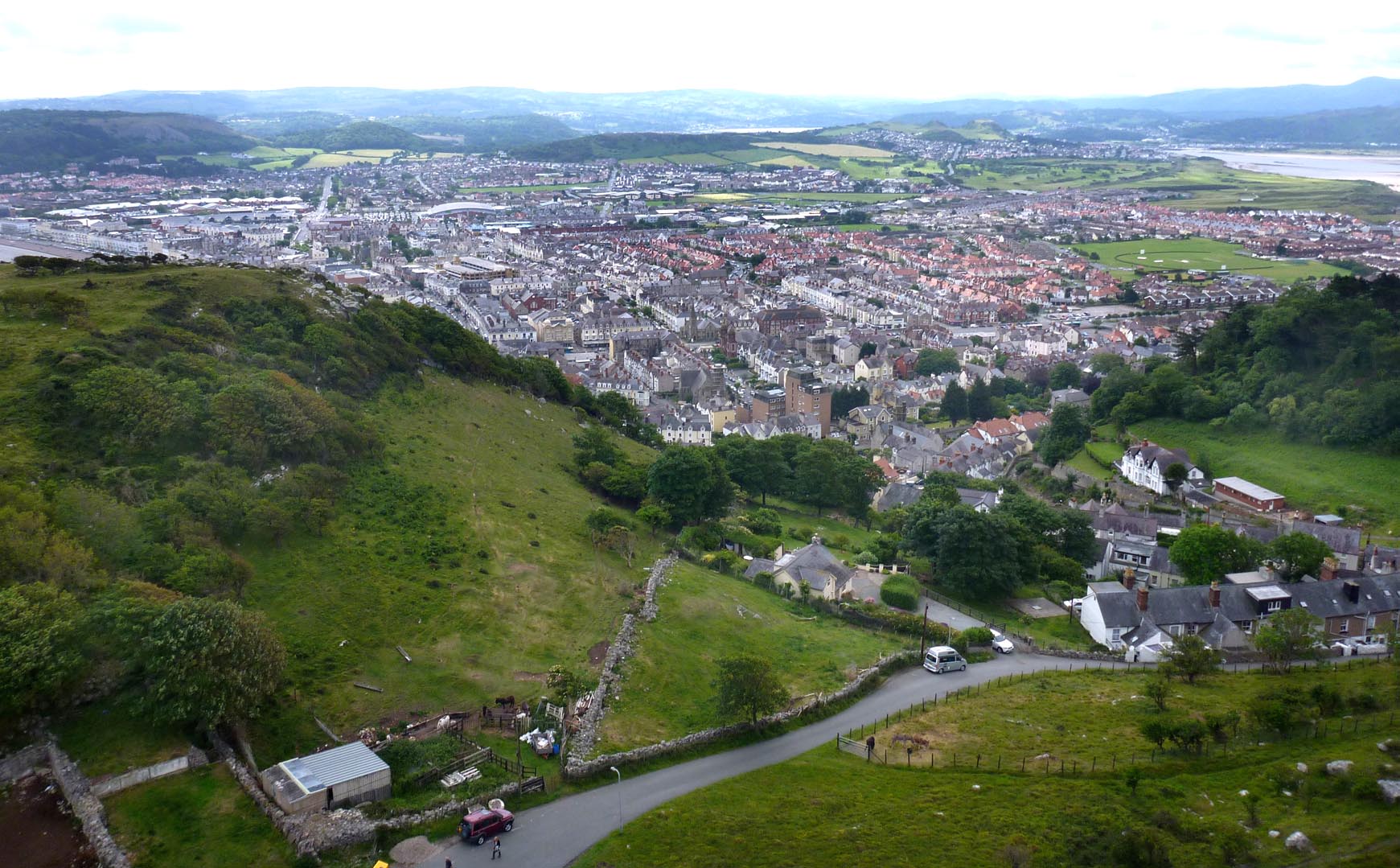
WPW003028 WALES (1920). View of Llandudno showing town, oblique aerial view. 5"x4" black and white glass plate negative.

© Copyright OpenStreetMap contributors and licensed by the OpenStreetMap Foundation. 2026. Cartography is licensed as CC BY-SA.
Nearby Images (48)
WPW003014

WPW003015

WPW003016

WPW003017

WPW003018

WPW003019

WPW003020

WPW003021

WPW003022

WPW003023

WPW003024

WPW003025

WPW003026

WPW003027

WPW003028

WPW003029

WPW003030

WPW003031

WPW003032

WPW003033

WPW003034

WPW003035

WPW009501

WPW009502

WPW009503

WPW009504

WPW009505

WPW009506

WPW009507
, oblique aerial view. 5\"x4\" black and white glass plate negative.")
WPW009508

WPW009509
, oblique aerial view. 5\"x4\" black and white glass plate negative.")
WPW009510
, oblique aerial view. 5\"x4\" black and white glass plate negative.")
WPW009511
, oblique aerial view. 5\"x4\" black and white glass plate negative.")
WPW009512
, oblique aerial view. 5\"x4\" black and white glass plate negative.")
WPW009513
, oblique aerial view. 5\"x4\" black and white glass plate negative.")
WPW009514
, oblique aerial view. 5\"x4\" black and white glass plate negative.")
WPW009515
, oblique aerial view. 5\"x4\" black and white glass plate negative.")
WPW009516
, oblique aerial view. 5\"x4\" black and white glass plate negative.")
WPW009517
, oblique aerial view. 5\"x4\" black and white glass plate negative.")
WPW009518
, oblique aerial view. 5\"x4\" black and white glass plate negative.")
WPW009519
, oblique aerial view. 5\"x4\" black and white glass plate negative.")
WPW040118

WPW040119

WPW040120

WPW040121

WPW040122

WPW045175

WPW045176

Details
| Title | [WPW003028] View of Llandudno showing town, oblique aerial view. 5"x4" black and white glass plate negative. |
| Reference | WPW003028 |
| Date | July-1920 |
| Link | Coflein Archive Item 6370272 |
| Place name | |
| Parish | |
| District | |
| Country | WALES |
| Easting / Northing | 278000, 382000 |
| Longitude / Latitude | -3.8317610743088, 53.320577115954 |
| National Grid Reference | SH780820 |
Pins

steffster |
Wednesday 7th of October 2020 11:13:59 AM | |
|
totoro |
Monday 2nd of July 2012 03:37:56 PM | |
|
totoro |
Monday 2nd of July 2012 03:35:18 PM | |
Note that the railway station belongs in the bottom left corner, not the right- this image needs to be flipped! |
totoro |
Friday 6th of July 2012 11:05:13 AM |
|
totoro |
Monday 2nd of July 2012 03:35:00 PM | |
|
totoro |
Monday 2nd of July 2012 03:33:39 PM | |
|
totoro |
Monday 2nd of July 2012 03:32:41 PM | |
|
totoro |
Monday 2nd of July 2012 03:28:28 PM |
User Comment Contributions
Llandudno from a Cable Car on the Great Orme |

Alan McFaden |
Wednesday 8th of October 2014 09:12:27 AM |
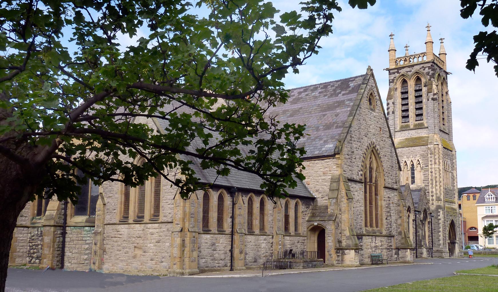
Trinity Church Llandudno |
Alan McFaden |
Wednesday 8th of October 2014 09:11:40 AM |
Now that's really confusing! It's taken me at least 20 minutes to figure out what's wrong with this picture........Its reversed! Trinity Avenue (West of Trinity church) is to the right and Vaughan Street (to its East - with the railway station) is visible in the bottom right corner. |

SteveBailey |
Monday 2nd of July 2012 03:27:22 PM |
Yep the image needs to be flipped |
totoro |
Monday 2nd of July 2012 03:27:22 PM |