
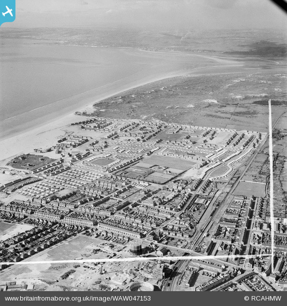
WAW047153 WALES (1952). View of newly-built housing at the Sandsfield Estate, Aberavon
© Copyright OpenStreetMap contributors and licensed by the OpenStreetMap Foundation. 2025. Cartography is licensed as CC BY-SA.
Nearby Images (11)
WAW047150

WAW047151

WAW047152

WAW047153

WAW047154

WAW047155

WAW047156

WAW047157

WAW047158

WAW047159

WAW047160

Details
| Title | [WAW047153] View of newly-built housing at the Sandsfield Estate, Aberavon |
| Reference | WAW047153 |
| Date | 1952 |
| Link | Coflein Archive Item 6414587 |
| Place name | |
| Parish | |
| District | |
| Country | WALES |
| Easting / Northing | 274070, 190850 |
| Longitude / Latitude | -3.8185228975281, 51.601920477344 |
| National Grid Reference | SS741909 |
Pins

sloyne |
Wednesday 6th of October 2021 01:45:46 AM | |
|
sloyne |
Wednesday 6th of October 2021 01:43:12 AM | |
|
sloyne |
Wednesday 6th of October 2021 01:42:40 AM | |
|
sloyne |
Wednesday 6th of October 2021 01:41:32 AM | |
|
sloyne |
Wednesday 6th of October 2021 01:40:38 AM | |
|
sloyne |
Wednesday 6th of October 2021 01:39:52 AM | |
|
sloyne |
Wednesday 6th of October 2021 01:38:40 AM | |
|
sloyne |
Thursday 23rd of July 2015 08:08:17 PM | |
|
sloyne |
Thursday 23rd of July 2015 08:07:18 PM | |
|
sloyne |
Thursday 23rd of July 2015 08:06:17 PM | |
|
sloyne |
Thursday 23rd of July 2015 08:05:36 PM | |
|
sloyne |
Thursday 23rd of July 2015 08:03:39 PM | |
|
gBr |
Tuesday 6th of January 2015 08:12:00 PM | |
|
gBr |
Tuesday 6th of January 2015 08:11:16 PM | |
|
gBr |
Tuesday 6th of January 2015 07:50:56 PM | |
|
Ifor |
Friday 18th of July 2014 11:41:06 AM | |
|
Mike Floate |
Friday 23rd of May 2014 09:44:40 PM |