
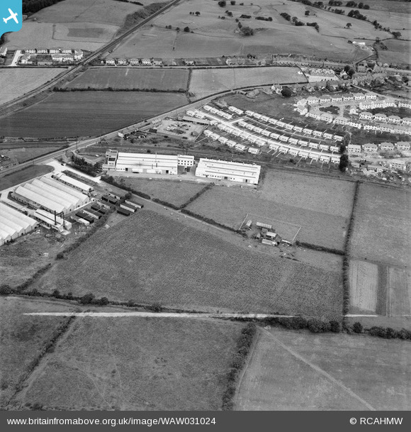
WAW031024 WALES (1950). View of factories and housing near Talbot Green, including temporary prefab housing
© Copyright OpenStreetMap contributors and licensed by the OpenStreetMap Foundation. 2026. Cartography is licensed as CC BY-SA.
Nearby Images (9)
WAW031021

WAW031022

WAW031023

WAW031024

WAW031025

WAW031026

WAW031027

WAW031028

WAW031029

Details
| Title | [WAW031024] View of factories and housing near Talbot Green, including temporary prefab housing |
| Reference | WAW031024 |
| Date | 1950 |
| Link | Coflein Archive Item 6414257 |
| Place name | |
| Parish | |
| District | |
| Country | WALES |
| Easting / Northing | 303767, 182424 |
| Longitude / Latitude | -3.387524636279, 51.532031969535 |
| National Grid Reference | ST038824 |
Pins

Railway Routes |
Thursday 13th of January 2022 04:03:50 PM | |
|
Railway Routes |
Thursday 13th of January 2022 04:03:26 PM | |
|
Railway Routes |
Thursday 13th of January 2022 04:02:46 PM | |
|
Railway Routes |
Thursday 13th of January 2022 04:02:19 PM | |
|
Railway Routes |
Thursday 13th of January 2022 04:01:37 PM |