
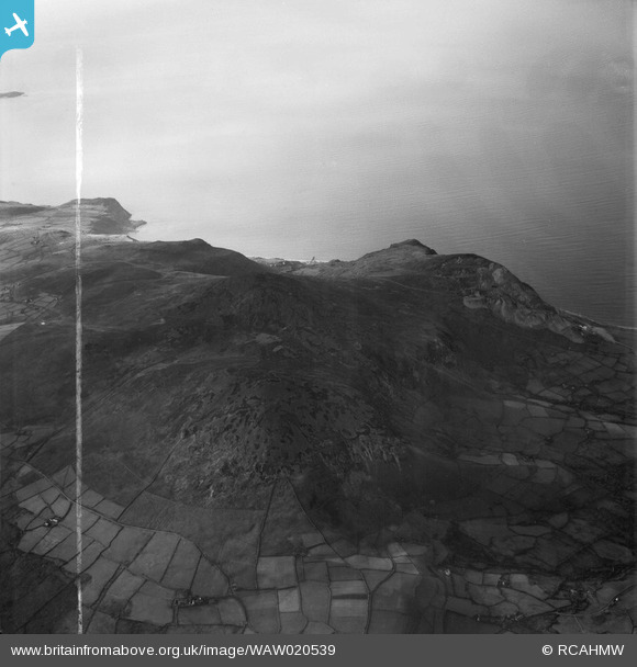
WAW020539 WALES (1948). View of Trevor Quarry showing Tre'r Ceiri hillfort
© Copyright OpenStreetMap contributors and licensed by the OpenStreetMap Foundation. 2026. Cartography is licensed as CC BY-SA.
Nearby Images (14)
WAW020534

WAW020535

WAW020536

WAW020537

WAW020538

WAW020539

WAW020540

WAW020541

WAW020542

WAW020543

WAW020544

WAW020545

WAW020546

WAW020547

Details
| Title | [WAW020539] View of Trevor Quarry showing Tre'r Ceiri hillfort |
| Reference | WAW020539 |
| Date | 10-November-1948 |
| Link | Coflein Archive Item 6413976 |
| Place name | |
| Parish | |
| District | |
| Country | WALES |
| Easting / Northing | 236320, 345870 |
| Longitude / Latitude | -4.4385492395972, 52.984821852855 |
| National Grid Reference | SH363459 |
Pins
Be the first to add a comment to this image!