
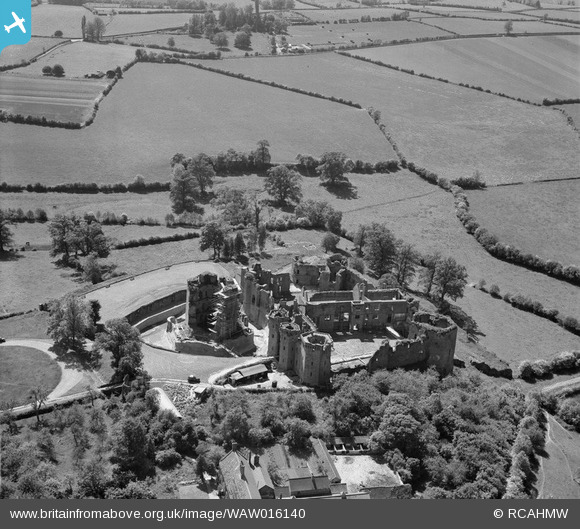
WAW016140 WALES (1948). View of Raglan castle showing castle farm
© Copyright OpenStreetMap contributors and licensed by the OpenStreetMap Foundation. 2026. Cartography is licensed as CC BY-SA.
Nearby Images (18)
WAW006553

WAW006554

WAW006555

WAW006556

WAW006557

WAW006558

WAW006559

WAW016136

WAW016137

WAW016138

WAW016139

WAW016140

WAW016141

WAW018011

WAW018012

WAW018013

WAW018014

WAW018015

Details
| Title | [WAW016140] View of Raglan castle showing castle farm |
| Reference | WAW016140 |
| Date | 21-May-1948 |
| Link | Coflein Archive Item 6413924 |
| Place name | |
| Parish | |
| District | |
| Country | WALES |
| Easting / Northing | 341440, 208300 |
| Longitude / Latitude | -2.8487594101178, 51.769856735567 |
| National Grid Reference | SO414083 |
Pins

MB |
Friday 25th of April 2014 12:09:00 PM | |
|
MB |
Friday 25th of April 2014 12:08:27 PM | |
|
MB |
Friday 25th of April 2014 12:07:42 PM | |
|
MB |
Friday 25th of April 2014 12:07:27 PM | |
|
MB |
Friday 25th of April 2014 12:06:57 PM | |
|
MB |
Friday 25th of April 2014 12:06:38 PM | |
|
MB |
Friday 25th of April 2014 12:05:53 PM | |
|
MB |
Friday 25th of April 2014 12:05:24 PM | |
|
MB |
Friday 25th of April 2014 12:00:41 PM | |
|
MB |
Friday 25th of April 2014 11:59:36 AM | |
|
MB |
Friday 25th of April 2014 11:58:40 AM | |
|
MB |
Friday 25th of April 2014 11:57:51 AM |