
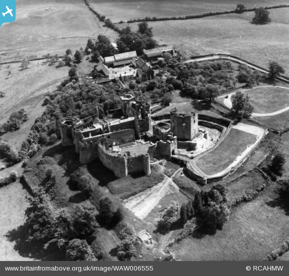
WAW006555 WALES (1947). View of Raglan Castle and Castle Farm. Oblique aerial photograph, 5½" cut roll film.
© Copyright OpenStreetMap contributors and licensed by the OpenStreetMap Foundation. 2026. Cartography is licensed as CC BY-SA.
Nearby Images (18)
WAW006553

WAW006554

WAW006555

WAW006556

WAW006557

WAW006558

WAW006559

WAW016136

WAW016137

WAW016138

WAW016139

WAW016140

WAW016141

WAW018011

WAW018012

WAW018013

WAW018014

WAW018015

Details
| Title | [WAW006555] View of Raglan Castle and Castle Farm. Oblique aerial photograph, 5½" cut roll film. |
| Reference | WAW006555 |
| Date | 31-May-1947 |
| Link | Coflein Archive Item 6422842 |
| Place name | |
| Parish | |
| District | |
| Country | WALES |
| Easting / Northing | 341440, 208300 |
| Longitude / Latitude | -2.8487594101178, 51.769856735567 |
| National Grid Reference | SO414083 |
Pins
Be the first to add a comment to this image!