
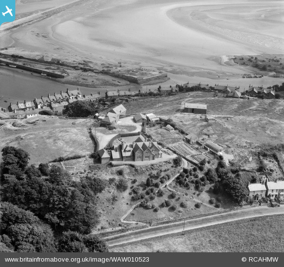
WAW010523 WALES (1947). View of Pen-y-Bryn, Garth, Portmadog, commissioned by S. V. Beer
© Copyright OpenStreetMap contributors and licensed by the OpenStreetMap Foundation. 2026. Cartography is licensed as CC BY-SA.
Nearby Images (9)
WAW010517

WAW010518

WAW010519

WAW010520

WAW010521

WAW010522

WAW010523

WAW010524

WAW010525

Details
| Title | [WAW010523] View of Pen-y-Bryn, Garth, Portmadog, commissioned by S. V. Beer |
| Reference | WAW010523 |
| Date | 30-August-1947 |
| Link | Coflein Archive Item 6413683 |
| Place name | |
| Parish | |
| District | |
| Country | WALES |
| Easting / Northing | 256677, 338306 |
| Longitude / Latitude | -4.1321648743173, 52.922698296483 |
| National Grid Reference | SH567383 |
Pins

Matt Aldred edob.mattaldred.com |
Thursday 4th of March 2021 01:35:49 PM | |

Morgan |
Friday 5th of February 2021 03:31:12 PM | |

MB |
Friday 25th of April 2014 12:35:39 PM | |
Marked as New Wharf on the 1900 Ordnance Survey map, this was then covered with a gridded network of narrow gauge rail lines, linked by wagon turntables and served by the Ffestiniog Railway, which brought slate from Tan-y-Grisiau and Blaenau Ffestiniog |
MB |
Friday 25th of April 2014 12:48:46 PM |
|
MB |
Friday 25th of April 2014 12:33:51 PM | |
|
MB |
Friday 25th of April 2014 12:32:53 PM |
