
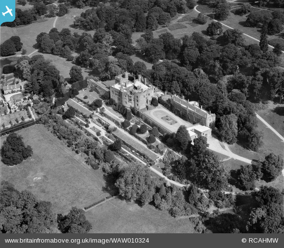
WAW010324 WALES (1947). View of Powis Castle
© Copyright OpenStreetMap contributors and licensed by the OpenStreetMap Foundation. 2026. Cartography is licensed as CC BY-SA.
Nearby Images (12)
WAW007989

WAW007990

WAW007991

WAW007992

WAW007993

WAW007994

WAW010321

WAW010322

WAW010324

WAW023768

WAW023771

WAW023772

Details
| Title | [WAW010324] View of Powis Castle |
| Reference | WAW010324 |
| Date | 25-August-1947 |
| Link | Coflein Archive Item 6413611 |
| Place name | |
| Parish | |
| District | |
| Country | WALES |
| Easting / Northing | 321581, 306455 |
| Longitude / Latitude | -3.1592831804335, 52.649802381848 |
| National Grid Reference | SJ216065 |
Pins
Be the first to add a comment to this image!
User Comment Contributions
This image is actually in reverse i.e. it is the mirror image of the correct view |

Sue |
Tuesday 24th of February 2015 01:56:11 PM |
Well spotted! |
Colin Rogers |
Tuesday 24th of February 2015 01:56:11 PM |
Hello, I'm afraid that this one has been scanned the wrong way around. |
Colin Rogers |
Tuesday 24th of February 2015 01:55:10 PM |