
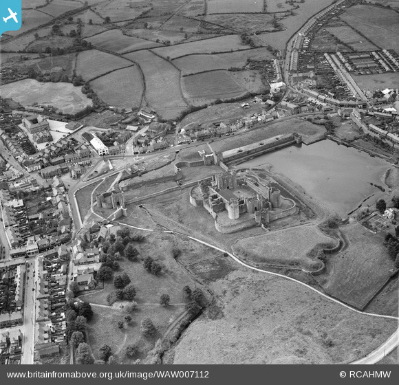
WAW007112 WALES (1947). View of Caerphilly showing castle and County Junior School
© Copyright OpenStreetMap contributors and licensed by the OpenStreetMap Foundation. 2025. Cartography is licensed as CC BY-SA.
Nearby Images (6)
WAW007108

WAW007109

WAW007110

WAW007111

WAW007112

WAW007113

Details
| Title | [WAW007112] View of Caerphilly showing castle and County Junior School |
| Reference | WAW007112 |
| Date | 11-June-1947 |
| Link | Coflein Archive Item 6413516 |
| Place name | |
| Parish | |
| District | |
| Country | WALES |
| Easting / Northing | 315000, 186000 |
| Longitude / Latitude | -3.2264697057673, 51.565984914921 |
| National Grid Reference | ST150860 |
Pins
Be the first to add a comment to this image!
User Comment Contributions
I think the photo has been reversed in scanning! Check a map… the funny shaped island by the castle is the giveaway. |

Mike Floate |
Saturday 15th of November 2014 12:00:06 AM |
Yes - I agree. I couldn't work out why the Twyn School looked so odd, or how the Castle Cinema could appear to be north of the castle entrance. Well spotted... |
pratjeffley |
Saturday 15th of November 2014 12:00:06 AM |