
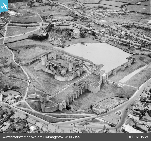
WAW005955 WALES (1947). View of Caerphilly showing castle
© Copyright OpenStreetMap contributors and licensed by the OpenStreetMap Foundation. 2026. Cartography is licensed as CC BY-SA.
Nearby Images (33)
WAW005950

WAW005951

WAW005952

WAW005953

WAW005954

WAW005955

WAW007641

WAW007642

WAW007643

WAW007644

WAW007647

WAW018008

WAW018009

WAW018010

WAW018660

WAW018661

WAW018662

WAW018663

WAW018664

WAW018665

WAW018666

WAW018667

WAW018668

WPW013836

WPW032443

WPW032444

WPW032445

WPW032447

WPW050477

WPW050478

WPW050479

WPW050481

WPW050482

Details
| Title | [WAW005955] View of Caerphilly showing castle |
| Reference | WAW005955 |
| Date | 15-May-1947 |
| Link | Coflein Archive Item 6413403 |
| Place name | |
| Parish | |
| District | |
| Country | WALES |
| Easting / Northing | 315527, 187066 |
| Longitude / Latitude | -3.2191238123639, 51.575647850147 |
| National Grid Reference | ST155871 |
Pins
Be the first to add a comment to this image!