
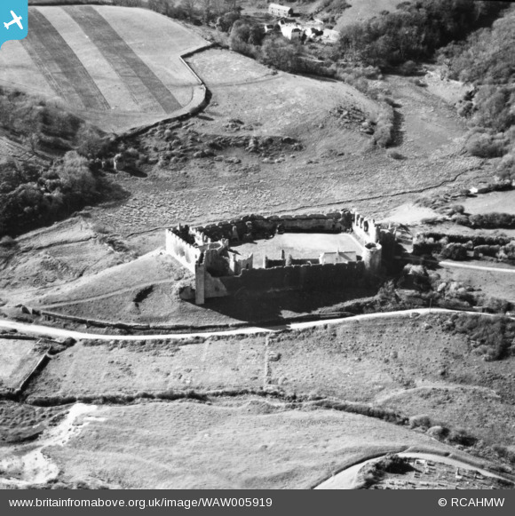
WAW005919 WALES (1947). View of Manorbier Castle. Oblique aerial photograph, 5½" cut roll film.
© Copyright OpenStreetMap contributors and licensed by the OpenStreetMap Foundation. 2026. Cartography is licensed as CC BY-SA.
Nearby Images (6)
WAW005917

WAW005918

WAW005919

WAW005922

WAW033685

WAW033686

Details
| Title | [WAW005919] View of Manorbier Castle. Oblique aerial photograph, 5½" cut roll film. |
| Reference | WAW005919 |
| Date | 15-May-1947 |
| Link | Coflein Archive Item 6422857 |
| Place name | |
| Parish | |
| District | |
| Country | WALES |
| Easting / Northing | 206390, 197790 |
| Longitude / Latitude | -4.7986731193922, 51.645057592968 |
| National Grid Reference | SS064978 |
Pins
Be the first to add a comment to this image!