
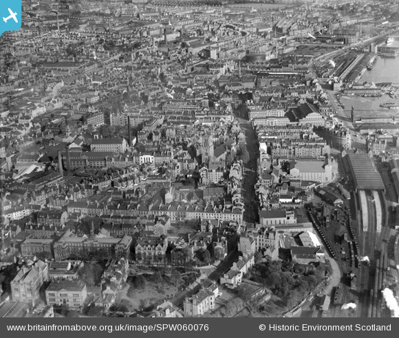
SPW060076 SCOTLAND (1938). Dundee, general view, showing Steeple Church, Nethergate and East Dock Street. An oblique aerial photograph taken facing north-east.
© Copyright OpenStreetMap contributors and licensed by the OpenStreetMap Foundation. 2026. Cartography is licensed as CC BY-SA.
Nearby Images (15)
SPW060076

SPW060073

SPW060075

SAW019554

SPW060072

SPW060074

SAR017651

SAR017652

SAR017653

SPW019925

SAW009822

SAW014833

SAW014835

SAW051265

SPW019930

Details
| Title | [SPW060076] Dundee, general view, showing Steeple Church, Nethergate and East Dock Street. An oblique aerial photograph taken facing north-east. |
| Reference | SPW060076 |
| Date | 1938 |
| Link | NRHE Collection item 1259538 |
| Place name | |
| Parish | DUNDEE (DUNDEE, CITY OF) |
| District | CITY OF DUNDEE |
| Country | SCOTLAND |
| Easting / Northing | 340136, 730121 |
| Longitude / Latitude | -2.9715243182049, 56.459532726018 |
| National Grid Reference | NO401301 |

