
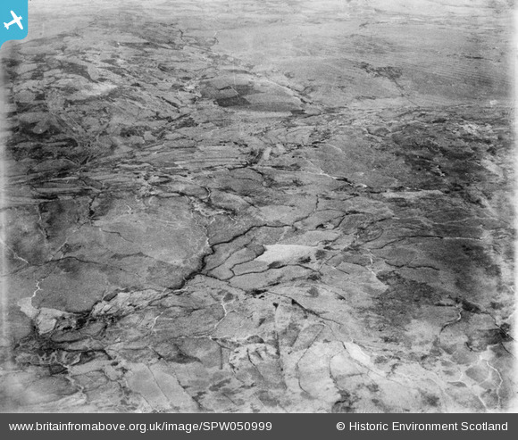
SPW050999 SCOTLAND (1936). Glenapp Estate. An oblique aerial photograph facing east.
© Copyright OpenStreetMap contributors and licensed by the OpenStreetMap Foundation. 2026. Cartography is licensed as CC BY-SA.
Nearby Images (5)
SPW050978

SPW050980

SPW050992

SPW050999

SPW051001

Details
| Title | [SPW050999] Glenapp Estate. An oblique aerial photograph facing east. |
| Reference | SPW050999 |
| Date | 1936 |
| Link | NRHE Collection item 1258065 |
| Place name | |
| Parish | BALLANTRAE (KYLE AND CARRICK) |
| District | KYLE AND CARRICK |
| Country | SCOTLAND |
| Easting / Northing | 208000, 573000 |
| Longitude / Latitude | -5.0033093572422, 55.014361946464 |
| National Grid Reference | NX080730 |
Pins

Class31 |
Monday 23rd of July 2012 02:18:29 PM | |
|
Class31 |
Monday 23rd of July 2012 02:17:27 PM | |
|
Class31 |
Monday 23rd of July 2012 02:16:10 PM | |
|
Class31 |
Monday 23rd of July 2012 02:15:43 PM | |
|
Class31 |
Monday 23rd of July 2012 02:14:53 PM |
User Comment Contributions
Dear Class 31, having looked at SPW050992 for some time and getting nowhere, this one really clarifies the topography, being taken at a slightly more oblique angle. The March Burn stands out very well, and is an excellent match for that drawn on the 3rd edition Ordnance Survey. One of its tributaries is marked as a Chalybeate Spring. The revised record will appear here in due course. Brian Wilkinson Britain from Above Activity Officer (Scotland) |

Brian Wilkinson |
Friday 31st of August 2012 03:06:40 PM |
Looking East to Drumcargo over March Burn and Wee Leith Hill with Loan of Turchloy and Mid Moile in the middle distance. |
Class31 |
Monday 23rd of July 2012 02:20:48 PM |