
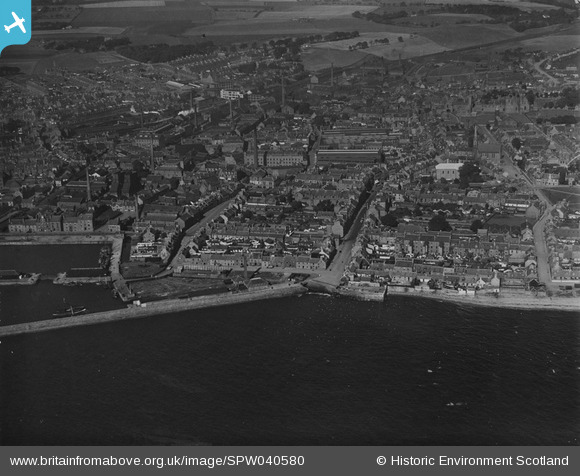
SPW040580 SCOTLAND (1932). Arbroath, general view, showing High Street and Marketgate. An oblique aerial photograph taken facing north. This image has been produced from a print.
© Copyright OpenStreetMap contributors and licensed by the OpenStreetMap Foundation. 2026. Cartography is licensed as CC BY-SA.
Nearby Images (2)
SPW040580

SPW040577

Details
| Title | [SPW040580] Arbroath, general view, showing High Street and Marketgate. An oblique aerial photograph taken facing north. This image has been produced from a print. |
| Reference | SPW040580 |
| Date | 1932 |
| Link | NRHE Collection item 1315566 |
| Place name | |
| Parish | ARBROATH AND ST VIGEANS |
| District | ANGUS |
| Country | SCOTLAND |
| Easting / Northing | 364331, 740712 |
| Longitude / Latitude | -2.5803494215421, 56.557139608694 |
| National Grid Reference | NO643407 |
Pins

cell |
Sunday 12th of May 2013 04:28:19 PM |
User Comment Contributions
Arbroath Power Station buildt by the Grampian Electric Supply Company Current Owner/ Owner at Close: NSHEB Gen Start Date: 1908 Gen Stop Date: >1952 Demolished: ? Station Size MW: 7.25 |
cell |
Sunday 12th of May 2013 04:31:15 PM |