
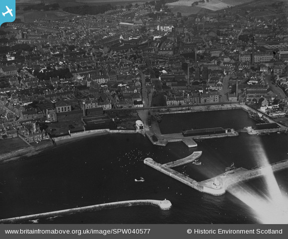
SPW040577 SCOTLAND (1932). Arbroath, general view, showing Arbroath Harbour and East Mary Street. An oblique aerial photograph taken facing north. This image has been produced from a print.
© Copyright OpenStreetMap contributors and licensed by the OpenStreetMap Foundation. 2026. Cartography is licensed as CC BY-SA.
Nearby Images (2)
SPW040577

SPW040580

Details
| Title | [SPW040577] Arbroath, general view, showing Arbroath Harbour and East Mary Street. An oblique aerial photograph taken facing north. This image has been produced from a print. |
| Reference | SPW040577 |
| Date | 1932 |
| Link | NRHE Collection item 1315565 |
| Place name | |
| Parish | ARBROATH AND ST VIGEANS |
| District | ANGUS |
| Country | SCOTLAND |
| Easting / Northing | 364120, 740550 |
| Longitude / Latitude | -2.5837598700041, 56.555668053808 |
| National Grid Reference | NO641406 |
Pins

cell |
Sunday 23rd of June 2013 04:51:31 PM |