
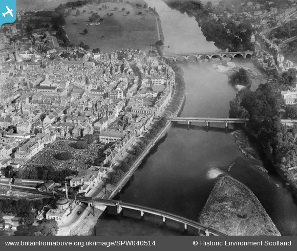
SPW040514 SCOTLAND (1932). Perth, general view, showing the Bridges and St John's Kirk of Perth. An oblique aerial photograph taken facing north.
© Copyright OpenStreetMap contributors and licensed by the OpenStreetMap Foundation. 2026. Cartography is licensed as CC BY-SA.
Nearby Images (11)
SPW040514

SPW040515

SAW022530

SAW022532

SAW022533

SAW022531

SPW020124

SPW020126

SAW022534

SAW022536

SAW022535

Details
| Title | [SPW040514] Perth, general view, showing the Bridges and St John's Kirk of Perth. An oblique aerial photograph taken facing north. |
| Reference | SPW040514 |
| Date | 1932 |
| Link | NRHE Collection item 1257545 |
| Place name | |
| Parish | PERTH |
| District | PERTH AND KINROSS |
| Country | SCOTLAND |
| Easting / Northing | 312077, 723457 |
| Longitude / Latitude | -3.4245159924797, 56.395276889384 |
| National Grid Reference | NO121235 |
Pins
Be the first to add a comment to this image!
User Comment Contributions
River Tay and Bridges, 1932 |

heavenstobetsie |
Tuesday 26th of June 2012 09:08:03 AM |