
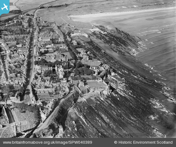
SPW040389 SCOTLAND (1932). St Andrews, general view, showing Castlecliff House, The Scores and St Andrews Castle. An oblique aerial photograph taken facing west.
© Copyright OpenStreetMap contributors and licensed by the OpenStreetMap Foundation. 2026. Cartography is licensed as CC BY-SA.
Nearby Images (13)
SPW040389

SAW016930

SAW016931

SAW024475

SPW020136

SAW016929

SAW016932

SPW040384

SAR018836

SAR018837

SAR018838

SAR018839

SAR018840

Details
| Title | [SPW040389] St Andrews, general view, showing Castlecliff House, The Scores and St Andrews Castle. An oblique aerial photograph taken facing west. |
| Reference | SPW040389 |
| Date | 1932 |
| Link | NRHE Collection item 1257456 |
| Place name | |
| Parish | ST ANDREWS AND ST LEONARDS |
| District | NORTH EAST FIFE |
| Country | SCOTLAND |
| Easting / Northing | 351177, 716975 |
| Longitude / Latitude | -2.7899131851335, 56.34269779005 |
| National Grid Reference | NO512170 |
Pins
Be the first to add a comment to this image!