
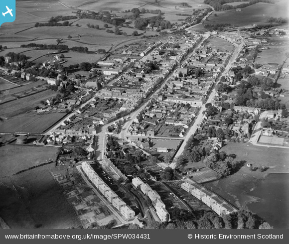
SPW034431 SCOTLAND (1930). Castle Douglas, general view, showing Carlingwark Street and Queen Street. An oblique aerial photograph taken facing north.
© Copyright OpenStreetMap contributors and licensed by the OpenStreetMap Foundation. 2026. Cartography is licensed as CC BY-SA.
Nearby Images (4)
SPW034431

SPW034432

SPW034430

SPW034429

Details
| Title | [SPW034431] Castle Douglas, general view, showing Carlingwark Street and Queen Street. An oblique aerial photograph taken facing north. |
| Reference | SPW034431 |
| Date | 1930 |
| Link | NRHE Collection item 1257159 |
| Place name | |
| Parish | KELTON |
| District | STEWARTRY |
| Country | SCOTLAND |
| Easting / Northing | 276304, 562181 |
| Longitude / Latitude | -3.9310767005264, 54.938858459373 |
| National Grid Reference | NX763622 |
Pins
Be the first to add a comment to this image!