
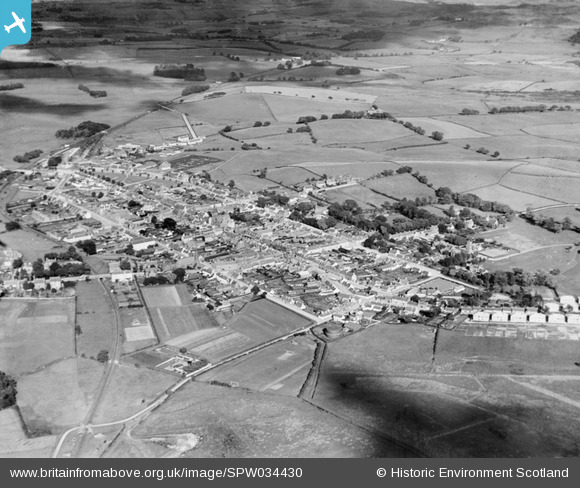
SPW034430 SCOTLAND (1930). Castle Douglas, general view, showing Cotton Street and Queen Street. An oblique aerial photograph taken facing east.
© Copyright OpenStreetMap contributors and licensed by the OpenStreetMap Foundation. 2026. Cartography is licensed as CC BY-SA.
Nearby Images (5)
SPW034430

SPW034429

SPW034431

SPW034432

SPW034434

Details
| Title | [SPW034430] Castle Douglas, general view, showing Cotton Street and Queen Street. An oblique aerial photograph taken facing east. |
| Reference | SPW034430 |
| Date | 1930 |
| Link | NRHE Collection item 1257158 |
| Place name | |
| Parish | KELTON |
| District | STEWARTRY |
| Country | SCOTLAND |
| Easting / Northing | 276460, 562210 |
| Longitude / Latitude | -3.9286553195447, 54.939157590549 |
| National Grid Reference | NX765622 |
Pins
Be the first to add a comment to this image!