
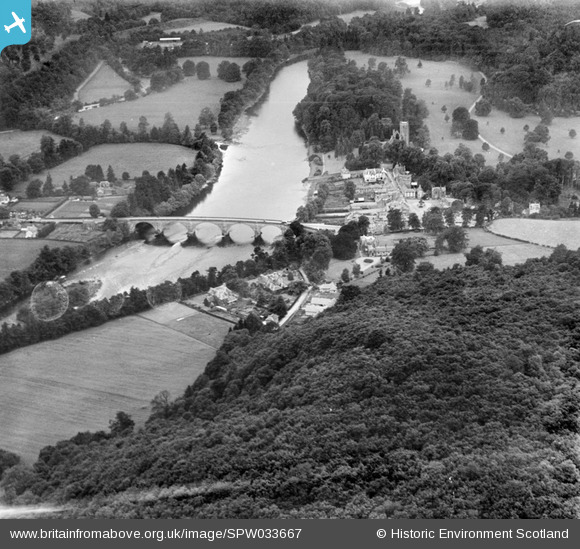
SPW033667 SCOTLAND (1930). Dunkeld, general view, showing Dunkeld Bridge and Cathedral Street. An oblique aerial photograph taken facing west.
© Copyright OpenStreetMap contributors and licensed by the OpenStreetMap Foundation. 2026. Cartography is licensed as CC BY-SA.
Nearby Images (13)
SAR016726

SAR016727

SPW033667

SPW040523

SPW040524

SPW040526

SPW033672

SPW033669

SAR016728

SAR016729

SAR016730

SPW033668

SPW040521

Details
| Title | [SPW033667] Dunkeld, general view, showing Dunkeld Bridge and Cathedral Street. An oblique aerial photograph taken facing west. |
| Reference | SPW033667 |
| Date | 1930 |
| Link | NRHE Collection item 1257013 |
| Place name | |
| Parish | DUNKELD AND DOWALLY |
| District | PERTH AND KINROSS |
| Country | SCOTLAND |
| Easting / Northing | 302675, 742453 |
| Longitude / Latitude | -3.5838752521206, 56.564049348449 |
| National Grid Reference | NO027425 |
Pins
Be the first to add a comment to this image!