
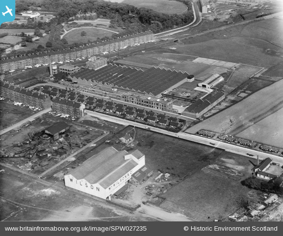
SPW027235 SCOTLAND (1929). Macfarlane, Lang and Co. Biscuit Factory, Clydeford Drive, Glasgow. An oblique aerial photograph taken facing east.
© Copyright OpenStreetMap contributors and licensed by the OpenStreetMap Foundation. 2026. Cartography is licensed as CC BY-SA.
Nearby Images (18)
SAW051738

SAW051740

SAW051744

SPW027232

SPW027233

SPW027234

SPW027235

SPW027236

SPW027237

SPW027238

SPW027239

SAW035573

SPW027255

SPW027256

SAW051741

SAW051742

SAW051743

SAW051745

Details
| Title | [SPW027235] Macfarlane, Lang and Co. Biscuit Factory, Clydeford Drive, Glasgow. An oblique aerial photograph taken facing east. |
| Reference | SPW027235 |
| Date | 1929 |
| Link | NRHE Collection item 1256809 |
| Place name | |
| Parish | GLASGOW (CITY OF GLASGOW) |
| District | CITY OF GLASGOW |
| Country | SCOTLAND |
| Easting / Northing | 263160, 663450 |
| Longitude / Latitude | -4.1857410332151, 55.844848162765 |
| National Grid Reference | NS632635 |
Pins
Be the first to add a comment to this image!