
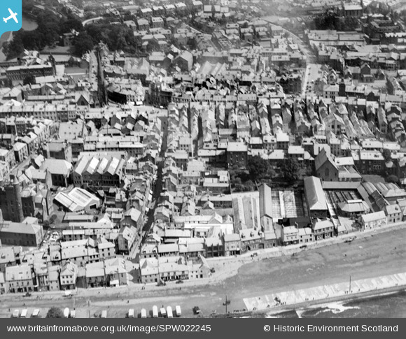
SPW022245 SCOTLAND (1928). Dumfries, general view, showing Friars Vennel and White Sands. An oblique aerial photograph taken facing north-east.
© Copyright OpenStreetMap contributors and licensed by the OpenStreetMap Foundation. 2026. Cartography is licensed as CC BY-SA.
Nearby Images (6)
SPW022245

SAR019969

SAR018995

SPW022240

SPW022241

SPW022243

Details
| Title | [SPW022245] Dumfries, general view, showing Friars Vennel and White Sands. An oblique aerial photograph taken facing north-east. |
| Reference | SPW022245 |
| Date | 1928 |
| Link | NRHE Collection item 1256559 |
| Place name | |
| Parish | DUMFRIES |
| District | NITHSDALE |
| Country | SCOTLAND |
| Easting / Northing | 297085, 576149 |
| Longitude / Latitude | -3.6118361638776, 55.069061495733 |
| National Grid Reference | NX971761 |
