
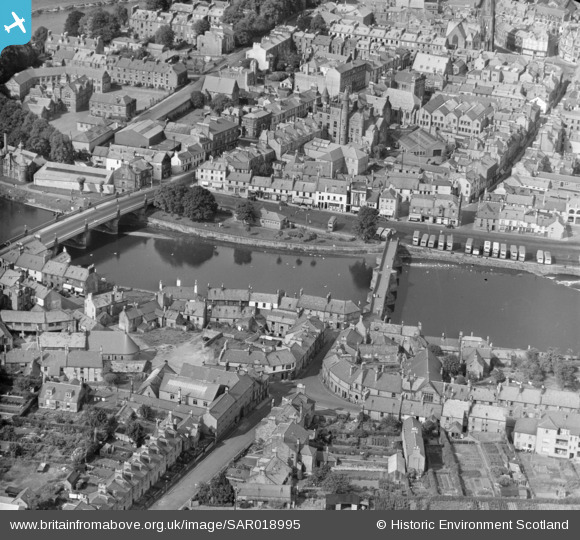
SAR018995 SCOTLAND (1953). Royal Infirmary Troqueer, Kirkcudbrightshire, Scotland. An oblique aerial photograph taken facing North/East.
© Copyright OpenStreetMap contributors and licensed by the OpenStreetMap Foundation. 2026. Cartography is licensed as CC BY-SA.
Nearby Images (5)
SAR018995

SAR019969

SPW022245

SPW022240

SPW022243

Details
| Title | [SAR018995] Royal Infirmary Troqueer, Kirkcudbrightshire, Scotland. An oblique aerial photograph taken facing North/East. |
| Reference | SAR018995 |
| Date | 1953 |
| Link | NRHE Collection item 1438171 |
| Place name | |
| Parish | DUMFRIES |
| District | NITHSDALE |
| Country | SCOTLAND |
| Easting / Northing | 297190, 576179 |
| Longitude / Latitude | -3.6102032210985, 55.069352752731 |
| National Grid Reference | NX972762 |
Pins
Be the first to add a comment to this image!