
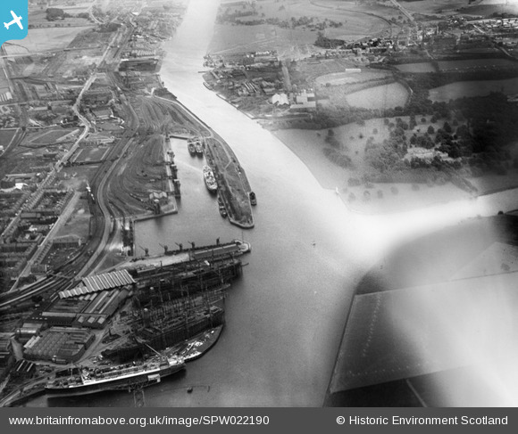
SPW022190 SCOTLAND (1928). Clyde Navigation Trustees Rothesay Dock, Clydebank. An oblique aerial photograph taken facing south-east.
© Copyright OpenStreetMap contributors and licensed by the OpenStreetMap Foundation. 2026. Cartography is licensed as CC BY-SA.
Nearby Images (6)
SAR031992

SPW022189

SPW022190

SPW022191

SPW022193

SAR014830

Details
| Title | [SPW022190] Clyde Navigation Trustees Rothesay Dock, Clydebank. An oblique aerial photograph taken facing south-east. |
| Reference | SPW022190 |
| Date | 1928 |
| Link | NRHE Collection item 1259315 |
| Place name | |
| Parish | OLD KILPATRICK (CLYDEBANK) |
| District | CLYDEBANK |
| Country | SCOTLAND |
| Easting / Northing | 250101, 669102 |
| Longitude / Latitude | -4.3972614277142, 55.891712305251 |
| National Grid Reference | NS501691 |
Pins

bankie |
Thursday 19th of December 2013 11:33:14 PM | |
|
bankie |
Thursday 19th of December 2013 11:32:07 PM | |
|
bankie |
Thursday 19th of December 2013 11:31:04 PM | |
|
bankie |
Thursday 19th of December 2013 11:29:17 PM | |
|
bankie |
Thursday 19th of December 2013 11:28:29 PM | |
|
bankie |
Thursday 19th of December 2013 11:27:51 PM | |
|
bankie |
Thursday 19th of December 2013 11:27:19 PM | |
|
bankie |
Thursday 19th of December 2013 11:26:17 PM |