
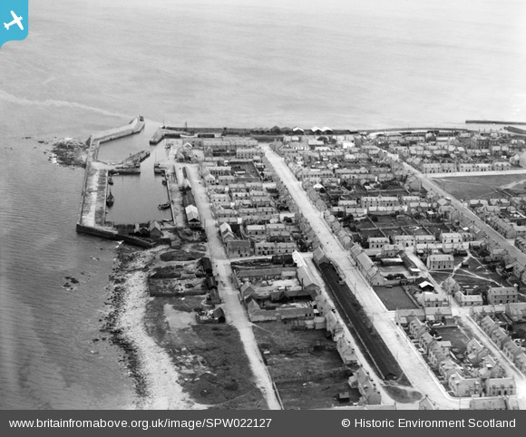
SPW022127 SCOTLAND (1928). Lossiemouth, general view, showing Commerce Street, Lossiemouth Harbour and Marina Quay. An oblique aerial photograph taken facing east.
© Copyright OpenStreetMap contributors and licensed by the OpenStreetMap Foundation. 2026. Cartography is licensed as CC BY-SA.
Nearby Images (4)
SPW022127

SPW022123

SPW040549

SPW040551

Details
| Title | [SPW022127] Lossiemouth, general view, showing Commerce Street, Lossiemouth Harbour and Marina Quay. An oblique aerial photograph taken facing east. |
| Reference | SPW022127 |
| Date | 1928 |
| Link | NRHE Collection item 1256497 |
| Place name | |
| Parish | DRAINIE |
| District | MORAY |
| Country | SCOTLAND |
| Easting / Northing | 323630, 871180 |
| Longitude / Latitude | -3.2823403689188, 57.724138757073 |
| National Grid Reference | NJ236712 |
Pins
Be the first to add a comment to this image!
User Comment Contributions
The long black building is the Ropery where Peterkin made ropes, originally for the sail boats. The photo is in the time of the steam drifters, say 1925. There are coal sheds but no oil tanks, and no market. the houses bottom centre with the long gardens had been the boat building yards of Wood Bros and of Slaters. Woods closed about then and Slaters moved to the new Harbour |

Donnie |
Sunday 1st of December 2013 07:51:03 PM |