
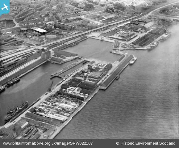
SPW022107 SCOTLAND (1928). Dundee, general view, showing Camperdown Dock and Queen Elizabeth Wharf. An oblique aerial photograph taken facing north-east.
© Copyright OpenStreetMap contributors and licensed by the OpenStreetMap Foundation. 2026. Cartography is licensed as CC BY-SA.
Nearby Images (8)
SPW019946

SPW022107

SPW019941

SPW019942

SPW022106

SPW040563

SPW019945

SPW019938

Details
| Title | [SPW022107] Dundee, general view, showing Camperdown Dock and Queen Elizabeth Wharf. An oblique aerial photograph taken facing north-east. |
| Reference | SPW022107 |
| Date | 1928 |
| Link | NRHE Collection item 1256480 |
| Place name | |
| Parish | DUNDEE (DUNDEE, CITY OF) |
| District | CITY OF DUNDEE |
| Country | SCOTLAND |
| Easting / Northing | 341216, 730418 |
| Longitude / Latitude | -2.9540668170094, 56.46233682523 |
| National Grid Reference | NO412304 |
Pins
Be the first to add a comment to this image!