
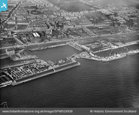
SPW019938 SCOTLAND (1927). Dundee, general view, showing Camperdown Dock and King George V Wharf. An oblique aerial photograph taken facing north.
© Copyright OpenStreetMap contributors and licensed by the OpenStreetMap Foundation. 2026. Cartography is licensed as CC BY-SA.
Nearby Images (8)
SPW019938

SPW022106

SPW040563

SPW019945

SPW019946

SPW022107

SPW019941

SPW019942

Details
| Title | [SPW019938] Dundee, general view, showing Camperdown Dock and King George V Wharf. An oblique aerial photograph taken facing north. |
| Reference | SPW019938 |
| Date | 1927 |
| Link | NRHE Collection item 1246342 |
| Place name | |
| Parish | DUNDEE (DUNDEE, CITY OF) |
| District | CITY OF DUNDEE |
| Country | SCOTLAND |
| Easting / Northing | 341322, 730540 |
| Longitude / Latitude | -2.9523741333296, 56.463446059187 |
| National Grid Reference | NO413305 |
Pins

Grant Buttars |
Monday 9th of November 2020 12:18:32 PM | |
|
Grant Buttars |
Monday 9th of November 2020 12:18:09 PM | |
|
Grant Buttars |
Monday 9th of November 2020 12:17:35 PM | |
|
Grant Buttars |
Monday 9th of November 2020 12:16:59 PM | |
|
Grant Buttars |
Monday 9th of November 2020 12:16:40 PM | |
|
Grant Buttars |
Monday 9th of November 2020 12:16:10 PM | |
|
Stobieer |
Sunday 19th of January 2014 09:54:20 PM | |
|
Stobieer |
Sunday 19th of January 2014 09:52:50 PM | |
|
Stobieer |
Sunday 19th of January 2014 09:48:44 PM | |
|
Stobieer |
Sunday 19th of January 2014 09:46:32 PM |