
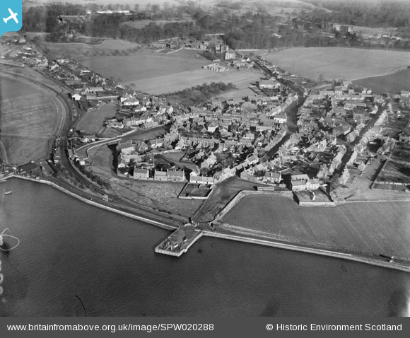
SPW020288 SCOTLAND (1928). Kincardine-on-Forth, general view, showing South Approach Road and East Pier. An oblique aerial photograph taken facing north.
© Copyright OpenStreetMap contributors and licensed by the OpenStreetMap Foundation. 2026. Cartography is licensed as CC BY-SA.
Nearby Images (6)
SPW020288

SPW020287

SAR018851

SAR018852

SAW019573

SAW019574

Details
| Title | [SPW020288] Kincardine-on-Forth, general view, showing South Approach Road and East Pier. An oblique aerial photograph taken facing north. |
| Reference | SPW020288 |
| Date | 1928 |
| Link | NRHE Collection item 1256202 |
| Place name | |
| Parish | TULLIALLAN |
| District | DUNFERMLINE |
| Country | SCOTLAND |
| Easting / Northing | 292928, 687376 |
| Longitude / Latitude | -3.7200353124836, 56.067271544234 |
| National Grid Reference | NS929874 |
Pins

Andy A |
Tuesday 7th of January 2014 03:19:12 PM |