
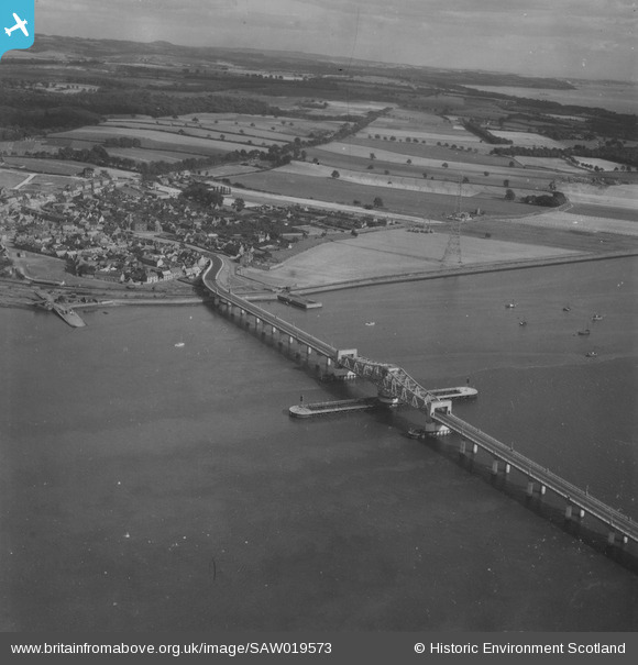
SAW019573 SCOTLAND (1948). Kincardine, general view, showing Kincardine on Forth Bridge and Walker Street. An oblique aerial photograph taken facing east. This image has been produced from a print.
© Copyright OpenStreetMap contributors and licensed by the OpenStreetMap Foundation. 2026. Cartography is licensed as CC BY-SA.
Nearby Images (3)
SAW019573

SPW020288

SPW020287

Details
| Title | [SAW019573] Kincardine, general view, showing Kincardine on Forth Bridge and Walker Street. An oblique aerial photograph taken facing east. This image has been produced from a print. |
| Reference | SAW019573 |
| Date | 1948 |
| Link | NRHE Collection item 1314958 |
| Place name | |
| Parish | TULLIALLAN |
| District | DUNFERMLINE |
| Country | SCOTLAND |
| Easting / Northing | 292800, 687200 |
| Longitude / Latitude | -3.7220200084137, 56.065662123828 |
| National Grid Reference | NS928872 |
Pins
Be the first to add a comment to this image!