
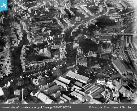
SPW020257 SCOTLAND (1928). Stirling, general view, showing Stirling Station and South Church. An oblique aerial photograph taken facing north.
© Copyright OpenStreetMap contributors and licensed by the OpenStreetMap Foundation. 2026. Cartography is licensed as CC BY-SA.
Nearby Images (12)
SPW020257

SPW040343

SAR008641

SAR008642

SAR008643

SAR018751

SAR019988

SAR023761

SPW040342

SPW020316

SPW020255

SPW040346

Details
| Title | [SPW020257] Stirling, general view, showing Stirling Station and South Church. An oblique aerial photograph taken facing north. |
| Reference | SPW020257 |
| Date | 1928 |
| Link | NRHE Collection item 1256663 |
| Place name | |
| Parish | STIRLING |
| District | STIRLING |
| Country | SCOTLAND |
| Easting / Northing | 279667, 693497 |
| Longitude / Latitude | -3.9356909553841, 56.119090068036 |
| National Grid Reference | NS797935 |
